SITUNET – To get a common picture of a situation
 02/06/2014

The basic functions of SITUNET are as follows:
- collect all relevant information for visualization on the Situnet interactive map (for example, a picture of an emergency services situation);
- optimization and unification of information on the status and development of the situation from different perspectives (views);
- provide a common (universal) connection with information resources through a standard interoperable interface;
- provide a view of the situation in real time and in another arbitrarily defined period;
- provide a visualization of the evolution of the situation over time, use models to simulate the movement of time during an exercise;
- generating information for the public and the media;
- automatically distribute important information to selected entities and receive information from them, including their own situational display;
- permit joint (shared) navigation – even through critical situations;
- concentrate all relevant and current information and clearly display it;
- provide a platform for decision making;
- make use of all information through an interoperable interface.
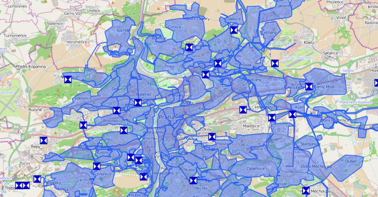
Show everything clearly and together on a map
- There is an online visualization of key information with a background map.
- Colour distinctions are based on specific design (output) criteria.
- It is possible to break the data down into layers, with the option to filter these views and the common view.
- The evolution of the incoming data can be recorded and archived.
- A multimedia output document can be generated.
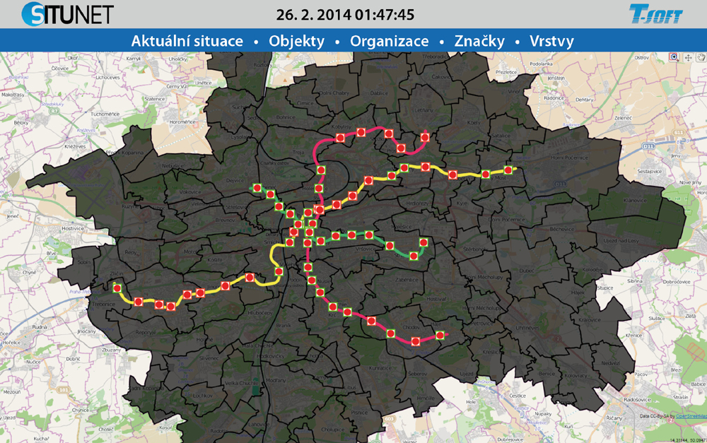
SITUNET maps were used for the Prague Blackout exercise
This crisis management exercise included crisis management staff and representatives of other entities that would be involved in handling this type of situation at the level of the Capital City of Prague.
The subject of the BLACKOUT 2014 exercise was to test out the response to an extensive power blackout in the Prague area and to verify the ability of the respective entities to respond and to do so in a timely and effective manner. The results of the exercise included the following:
- an online map providing a view of key information;
- the coordination of movement and documenting of key decisions;
- verification of the cooperation and interaction of the respective organizations and entities involved in dealing with this type of situation.
More articles from: Cisis management
SITUNET – To get a common picture of a situation
The basic functions of SITUNET are as follows: collect all relevant information for visualization on the Situnet interactive map (for example, a picture of an emergency services situation); optimization and unification […]
Read moreT-SOFT Provides Information System and Visualization Support for the BLACKOUT 2014 Exercise
On Wednesday, February 26, 2014, the Prague City Council conducted an exercise to gauge the City’s readiness to deal with a power blackout. T-SOFT provided software experts and technicians to help visualize […]
Read moreT-SOFT hosted specialized workshop for the research project No. VG2010201403 – ROCK – “Information expert system for early warning and notification as a result of the rock avalanche risk analysis”
The workshop was attended by representatives of the local administration, Integrated Emergency System, National Park České Švýcarsko and Ministry of Interior. The goal of the workshop was to inform attendants with the […]
Read more